NATIONAL HIKING TRAIL
TRAIL DESCRIPTION
The trail is part of the National Hiking Trail network which already has more than 800 km in Quebec and nearly 3000 km across the country. When the various sections of the proposed trail are completed, they will annex the existing national trail in the west (Trois-Pistoles) and the International Appalachian Trail to the east (Matapedia region).
The total length of the Chute-Neigette/Mont-Comi trail is 12.9 km, but it can be done in two sections: 5.6 km from Mont-Comi up to des Écorchis Range and 6.8 km from des Écorchis Range to Chutes Neigette.
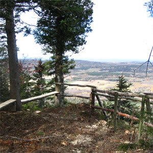
Add about 500 meters of walking in the des Écorchis Range to get the total length of the trail. The landscape is spectacular from many points of view and the trail also provides access to spectacular views of the majestic St. Lawrence River.
ACCESS TO THE TRAIL
There are three access points to the trail:
- Chutes Neigette
- Des Écorchis Range in St. Donat (no parking is arranged)
- Parc du Mont-Comi (chairlift # 2, via the “Panoramique” trail)

REGIONAL ATTRACTIONS
The trail provides easy access to a few major tourist attractions in the La Mitis and La Neigette regions, including Parc du Mont-Comi, the Valga Domain and the Chutes Neigette.
Galerie NATIONAL HIKING TRAIL


-
Address
Parc du Mont-Comi
300, chemin du Plateau
Saint-Donat-de-Rimouski (Québec)
G0K 1L0Booking
Phone.: 418-739-4858
No charge : 1-866-739-4859
Telecommunication : 418-739-5022
Email : [email protected]

